
@iau-wgsn.bsky.social
BlueSky - our IAU edu infos
Please Contact Us
Channel
@iau-wgsn.bsky.social
BlueSky - our IAU edu infos
Please Contact Us
Channel
…. in astronomy
More on the ecliptic and galactic coordinate system later.
|
||||||||||||||||||||||||||||||||||||||
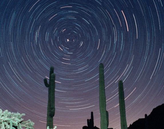
The height of the celestial pole above the horizon corresponds to the latitude of the observation location. = At the equator, Polaris is directly on the horizon; in the southern hemisphere it is never above the horizon. In the northern hemisphere, the stars move in inclined arcs from east via south to west; at the equator, the stars rise and fall vertically; in the southern hemisphere, they move in inclined arcs from east via north to west.
Azimuth a … indicates the distance to the meridian in degrees. In geography and astronomy, the counting directions are different, which often causes confusion. In astronomy, the classic way of counting is in the direction of the (daily) celestial rotation, i.e. from east to west.
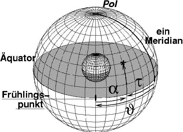
Hour angle τ … Angular distance of a celestial body to the meridian. Is counted with the (daily) celestial motion to the west and measured in time units (h, m, s).
Right ascension α … Distance of the celestial body from the vernal equinox. Is counted with the (annual, i.e. “correct”) movement of the sun to the east and measured in units of time (h, m, s).
Sidereal time θ … is the hour angle of the vernal equinox and thus mediates between the hour angle of an object and its right ascension.
Vernal equinox ϒ … the intersection of the ecliptic with the celestial equator at which the sun is at the vernal equinox (approx. 21.03.); for historical reasons also called Aries point ϒ, although it is now in Pisces (Psc).
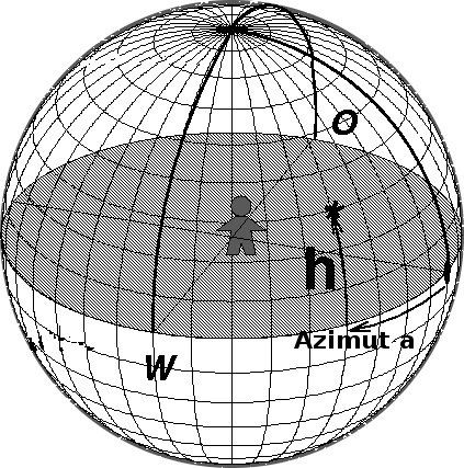

Horizon system of astronomy: During the course of the night, the apparent celestial sphere rotates around the rotation poles of the sky. There is currently a very conspicuous star near it, which is therefore called the Pole Star.
The height of the north celestial pole corresponds to the latitude of the observation site.
The image can be downloaded and used for teaching purposes: please cite the source as “online teaching material collection exopla.net”
The stars therefore follow paths in the sky at night, which can be photographed as line trails; above is an example.
Equatorial system(s)
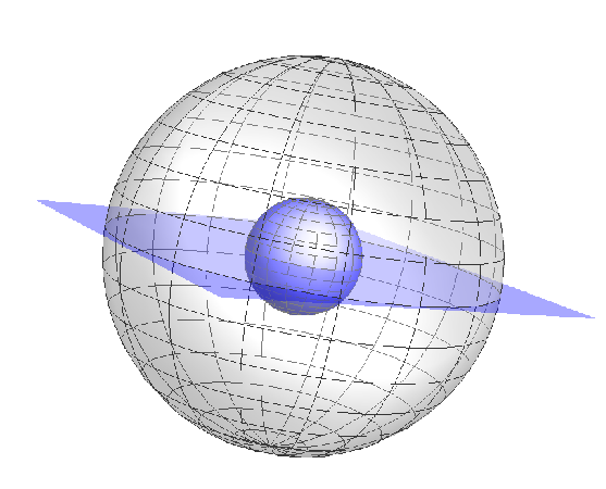
In the modern equator system, we simply project the Earth’s usual coordinate system onto the sky. This creates a celestial equator around whose poles the apparent celestial sphere rotates.
© 2025All Rights Reserved, Safari WordPress Theme